This trip to Balaclava Island and the God's Pocket area was a trip I co-lead with a group of NSSKA kayak club members, several of whom had not done a wilderness trip. Prior to this trip the group held a planning meeting to review individual responsibilities, develop our trip plan, paddle plan and our travel plans to Port Hardy, British Columbia, Canada.
Saturday July 6, 2019: Group members made their way to Port Hardy then we visited the local museum, coffee shops, bakery and lone grocery store. Late afternoon the group assembled at Sporty's Bar & Grill to firm up the next day's launch time, launch location (Carrot Park), review segment trip leaders and parking for the trip.
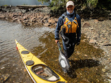
Sunday July 7: The 9 person group hit the water at 07:30 under fair skies and calm winds. Our first set of leaders took us to Duval Point then a left turn as we journeyed along the east coast of Vancouver Island up Goletas Channel to Songhees Creek arriving at 09:45. This is a beautiful location with a year round water supply and plenty of camping space for a larger group. Mother bear and her cub greeted us upon our arrival. The bear family worked the hightide line for the entire time we were on the beach, very cool !! The plan is to have our second set of leaders take us across the 2 1/2 mile wide Goletas Channel to our planned camp site at Nolan Point. Nolan Point will serve as our home base from which we will do day paddles for the trips duration. Although there was blue skies above, the channel was covered in a very dense sea fog which began to lift after an hour beach rest. Once the fog began to lift we could see the top's of Nigei, Balaclave, Hurst and Bell Island to the east of our position on Songhees Creek. Our leaders took us to the Nobel Islets then adjusted our course to Nolan Point. Once at Balaclava Island the very popular Nolan Point campsite was being utilized by a group of paddlers so we journeyed up Browning Passage and our campsite under a huge canopy of conifer trees. We spread out our tents, set up the group cooking tarps and had our home sweet home established at 12:45 pm. ( roughly 11 1/2 miles of paddling).
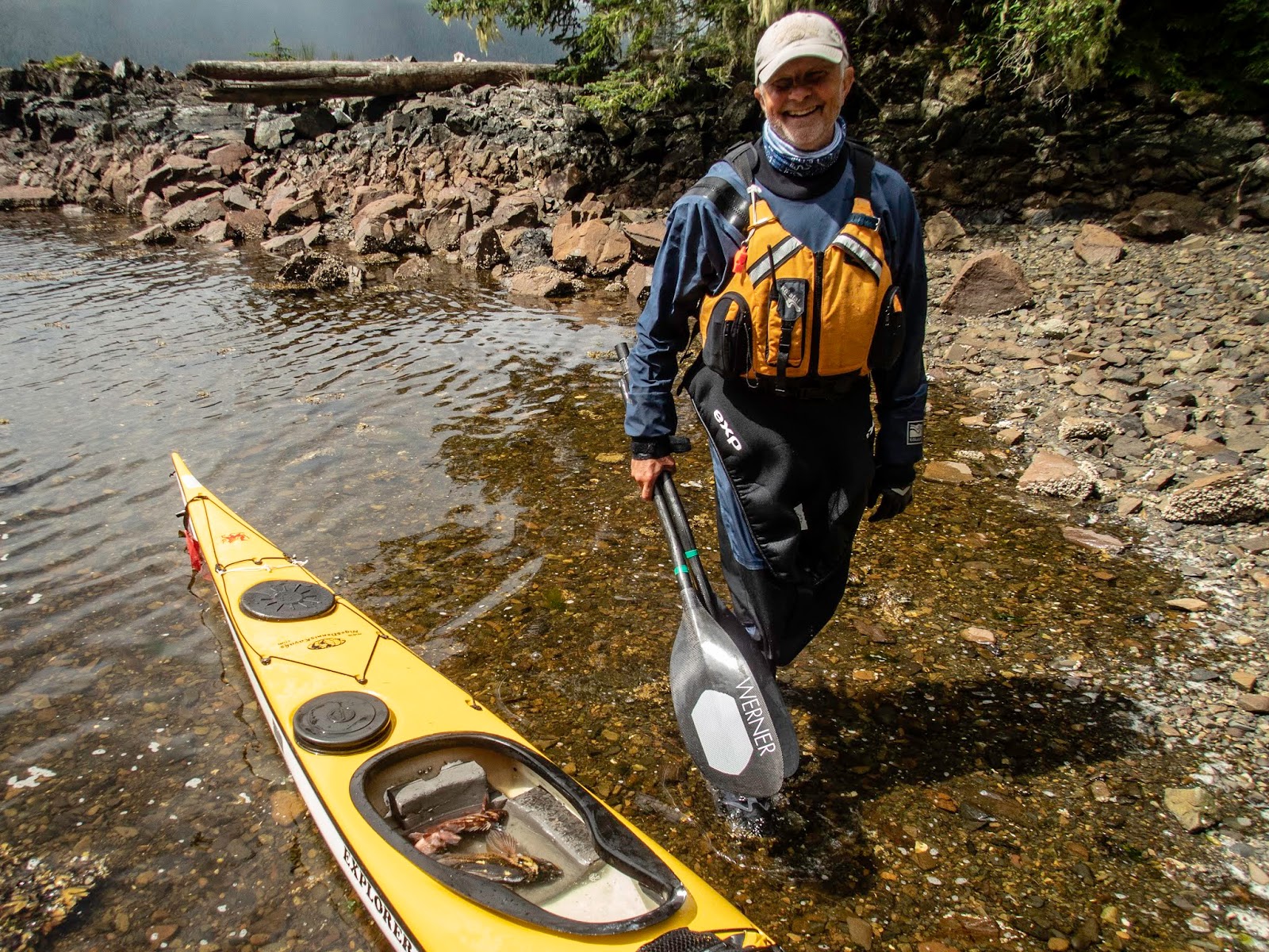
Monday July 8:We were awaken by the shrill squawking of a group of juvenile ravens who for the duration of our stay spent their EARLY mornings whining at their parents for breakfast. Lots of eagles also inhabit this location. Also noticeable was wolf scat along the game trails which cover the island. There are no bears that inhabit permanently, as I understand from the local lighthouse keeper they ate all the deer years before. The sea wolves are a subspecies that have adapted their diet to include the abundance of clams, oysters and muscles which line the islands shores. Today our paddle will be a clockwise circumnavigation of Balaclave Island with a stop/visit at the Scarlett Point lighthouse. Once at the lighthouse the longtime light keeper Ivan and his assistant gave us the grand tour ( they really do like visitors ) We left Ivan with a big batch of homemade cookies and a bottle of spiced rum. ( we have a friend forever!) Back in our kayaks we were immediately greeted by a large group of porpoise and a humpback whale. Our journey down Christie Passage was very pleasant, we could see the God's Pocket resort on Hurst Island as we headed back to our campsite. Several of us (we pre purchased BC fishing licenses) tried our fishing luck in Browning Passage catching several rock cod which we released after bragging to our fellow paddlers. ( roughly 9 miles of paddling)
Tuesday July 9: Today we paddled around the south end of Balaclava Island crossed Christie Passage over to the God's Pocket resort on Hurst Island. No visible activity at the resort so we lined up our boats in front of the colorful cottages took our obligatory pictures and moved on. Paddled clockwise around the rugged coastline to Harlequin Bay where we stopped for lunch. This bay is well protected and has several campsites but the bay is shallow and at low tide it can be a muddy slog out to the deeper water. Again we saw numerous whales, porpoise and sea otters on our journey.
( 10 1/2 miles of paddling ).
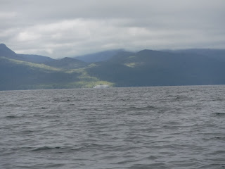
Wednesday July 10: Today is our "water run" day to a local water source at Clam Cove on Nigei Island. ( note: yesterday late afternoon and most of the night we had a steady light rain so we where able to capture all the water we needed). This is a paddle exposed to Queen Charlotte Strait and it can be challenging depending on wind speed and direction. Our paddle took us up Browning Channel to Gordon Channel and into Queen Charlotte Sound. Clan Cove is a protected mile long bay with a fish camp and anchoring spot for large fishing and pleasure boats. The water supply is from a creek which drains from a lake and is located at the end of the bay on the right hand side. On our return to camp we paddled along Browning Wall (Google it) with its rich and diverse collection of sea creatures. We had a humpback calf entertain us with some up close and personal dives. (@an 8 mile paddle)
Thursday July 11: Today we paddled along the exposed side of Lucan and Jerome Island on our way to Port Alexander which is a deep mile long bay on Nigei Island with a beautiful, nothing there but sand, rocks and a pine tree lined beach. We waited for slack tide by having a nice sunny lunch break and hike along the black shale beach. Then off we went to Browning Wall for a super slow paddle to admire amazing variety of sea life that covers this steep rock wall. Dozens of colorful sea stars, anemones, mussels, snails, translucent seaweeds, fish, kelp, sea fans and many, many more unique plants and animals make their homes here. We where also visited by a large grey whale that made several passes close to us. Just too cool !! ( paddled @ 7 miles )
Friday July 12: Say it isn't so... we just got here and it's time to head back to Port Hardy. Our third set of leaders have us up packed up and ready to launch at 07:30. It is a nice calm morning, with high overcast skies and no sea fog as we journey back to Songhees Creek. Numerous porpoise travel along with us occasionally surfacing amongst our group. After a snack and bio break at Songhees Creek our final set of trip leaders take command and have us doing a shore crawl as we make our way back to Nolan Point and then onto civilization in Port Hardy. ( again a 11 1/2 mile paddle).
Monday, March 2, 2020
Thursday, August 2, 2018
Balaclava Island (BC) revisited
Five paddlers Rhonda, Chris, Beth, Rob and Bill will travel to and meet up in Port Hardy BC on July 7th. We spent the next day hanging out in Port Hardy, a town we have visited many, many times enjoying a relaxing day, getting supplies, eating and visiting our favorite coffee shops.
July 9th
We take advantage of the ebb current in Goletas Channel so that dictated a nice casual (10:30 AM)start to our trip. We pack our boats, leave our vehicles at the hotel (North Shore Inn) and launch at Carrot Park which is right across the street from the hotel. It's a 2 hour paddle under overcast skies to Songhees Creek which is our first stretch/pee/snack stop. Loads of bear scat on the beach and one uninterested bear working for his/her lunch in the fast flowing creek. After a nice break we continue along the Vancouver Island coast line before making the 3 KM crossing of Goletas Channel. We make it to our campsite at 1:45 pm on Nolan Point. Bonus, the campsite is void of any other boaters or paddlers.
There was a little drizzle in the early evening, fortunately it came long after the tents and tarps were up. The couple hours of drizzle was the only precipitation we experienced the entire trip.
July 10th
Today was the day we paddled around the south end then up the east side of Balaclava Island to the Scarlett Pt lighthouse. Ivan, the lighthouse keeper provided a grand tour of the site, all the facilities, explained in loads of detail what a lightkeepers duties are. Me thinks he likes company ! This is well worth the effort to stop here, beautiful views from the lighthouse. After our visit with Ivan we journey on around the north side of the island. This side of the island is more exposed to the wind and waves and makes for a fun trip. After entering Browning Passage we stop at an alternate campsite to check it out and take a break. This site is located approximately a third of the way down the east side of Balaclava Island and used to be ( I understand) a logging site where loggers loaded barges with their plunder. It' about 10 / 11 miles around the island and it's worth noting currents in Browning Passage can zip you right along assuming your paddling with the current.
July 11th
Again, like the entire trip the morning greets us with calm overcast skies which clear around noonish and then the winds start. Most afternoons the northwesterly winds are blowing in the 15-20 knot range. Today I decide I'm going fishing and utilize my $35 CAD 5 day license investment. When we paddled the previous day down Browning Channel I was checking out potential protected ( out of the wind) fishing sites. I found an interesting fishing spot along the east side of the island approximately 1 mile from our camp site. Using both a casting rod and hand line, fishing in 45-60 feet of water, using a white jig head and pink/yellow hula skirt I caught one rock fish after another. When I had enough fish to feed the group I headed back to camp. I even caught a large sea cucumber which quickly got returned to the sea. Fish cooked in foil for dinner, o yummmm!
July 12th
Today our plan is for the group to paddle up to Clam Cove on Nigei Island to replenish our water supply. Having been to Clam Cove for a water run four years earlier we were sure their would be easy access to a stream which flows out of a rather large lake. (I'll note that there is a small stream that was flowing right at our campsite on Nolan Pt but the water was dark brown from all the tannins in the water.) There must have been some big winds/storms since my last visit to Clam Cove as the plastic pipe that carried the water from the lake down to a pier was smashed to bits. To hike up to the lake you would need to be a mountain goat so we searched around thru the forest and found a nice fast running stream that flowed from the lake high above us. We filtered all the water we needed for the duration of our trip, had a nice lunch in sunshine, jumped back into the boats for a windy, bumpy ride back to Nolan Pt. We saw a humpback breach a couple hundred yards from us and we had two very protective sea lions who encouraged us paddle elsewhere. The trip today was approximately 10 miles.
July 13th
No paddling today, just beach combing and hiking around the south end of the island. There are CMT's (culturally modified trees) at the Glen-gla-ouch (Heiltsuk) IR site which are worth hiking to and located close to Nolan Point.
July 14th
Today, two members of the group are going to the west side of Browning Wall at low tide to observe the truly abundant sea life that is attached to the shear cliff. Divers from around the world come to this site, it's also quite famous from a visit years ago by Jacques Cousteau. The other three of us are going to paddle around Hurst Island. We paddle around the south end of Balaclava, cross Christie Passage and swing by the God's Pocket Resorts, in hopes of catching a breakfast. Alas we smell no coffee brewing or bacon frying so we venture on around the island. This island, along with it's neighbor Bell Island are located within the boundaries of the God's Packet Marine Park so it's nicely remote ! As we head around the south end of the island you can see multiple fish pen operations along Duncan Island. This paddle took us a little over 3 hours and it was about 10 miles in distance. Back at campsite around 2 pm I decided to load up my fishing gear and test my luck one last time. Took me 15 minutes to paddle back to the same place I previously caught the fish and in 20 minutes I again had enough fish to feed the group, back to camp in an hour… Fish taco's over the campfire tonight and again yummmmm.
July 15th
We pack up and say bye to Nolan Point around 8:00am. It's a beautiful sunny morning with absolutely no wind. We crossed back over to Songhees Creek and again stop for a nice long break in the sunshine and to fully explore the long beach and creek. Back in our boats we hug the rocky shoreline to admire the sea life that clings to the sides of these rocks. On our return trip we paddle along the south side of Duval Island which is no problem for sea kayaks, fishing boats it could be a challenge with the water depth. Got back to Port Hardy around 1:50 pm, hit the hotel and showered and immediately headed to Sporty's Bar for that big greasy cheeseburger and cold beer....


Saturday, August 19, 2017
Bella Bella BC 2017
Bella Bella 2017 Trip Report
The big plan: The 3 of us,
Rob Freelove, Chris Smith and myself will meet at 5:30 am in Kirkland WA on
July 29th for the drive to the US/Canadian Peace Arch border crossing then to
the Tsawassen BC ferry terminal. Take the BC ferry to Nanimo BC (Duke Pt) then
drive the 5 1/2 hours to Port Hardy, BC.
Spend July 30th in Port Hardy, make all parking arrangements, acquire
any additional food items, pay for the Port Hardy to Bella Bella ferry ride (
make sure you make reservation long in advance for this ferry run). We have
reservation for the 7/31 7:30 am ferry to Bella Bella (note: good to be at the ferry office when they open
at 4:00 AM, parking is first come first serve, cost was $50 cad). Get off the
ferry after a 5 hour ride and paddle to camp site #1. Paddle 8 days and return
to Bella Bella for the ferry ride back to Port Hardy on August 7th.
July 31:
Under unusually warm (actually hot) sunny skies we got off the ferry at 1:30
ish, packed our boats ( very convenient, load and launch site right beside the
ferry dock). I'll mention if you coordinate with the BC ferry folks they will
have a kayak rack and cargo dolly available so we did not have to take our
wheels with us, a nice bonus not having to lash wheels to our boats.
We paddled north past
downtown Bella Bella, a beautiful light house, several totem poles and
Shearwater for 2 hours and 15 minutes to our first campsite at Kynumpt Harbour
(lat 52* 12.203 lng 128* 10.296). Nice relatively isolated camp site, had a
couple sail boats moored in the harbor, plenty of room to camp close to the
beach and in the woods. At low tide you could walk for approximately a mile
along the shore line and there were several trails to hike inland. This was a former village site. Saw a giant
Pacific octopus, a first for me in the wild. Several humpbacks patrolled the
outer edge of the bay, slamming their flukes time and time again, sounded like
cannons going off in the distance. Sadly
again this year there are massive forest fires in BC which of course create a
smoky haze in the air. We are well west of the fires so the only evidence of
the fires we experience are amazing
blood red sun rises.
Aug 1: This
morning under clear blue sunny skies we are on the water at 8:00 am paddling
west down Seaforth Channel towards the Pacific Ocean and our second camp site on
Athlone Island which is located at Yaaklele Entrance (lat 52* 13.256 lng
128*26.367).
The ocean is relatively
calm, low swell and there isn't much of a wind which made for easy paddling conditions.
Lot's for islets, big rocks, channels to cut thru and play around which we
discovered was the case for most of our trip. Our research suggested this campsite
is "well-protected" and it was. We paddled past it for a mile plus
before we dugout the GPS, turned around and went back north before we found the
channel into a small inland lagoon and a great campsite. We did see fresh bear scat here on our walks
around the campsite but never saw the bear(s). Had to watch out for the
abundance of blooming Devil's Club. Arrived at our campsite at 2:05 pm. Note:
on our journey down Seaforth Channel we stop several times to poke around on
remote people-less beaches, at Dennison Point there was a fast running stream which
we may visit on our return leg.
Aug 2:This
morning AGAIN under clear blue sunny skies we are on the water at 6:45 am for a
2 1/2 hour paddle south to our next campsite which is located at Cape Mark (lat
52*9.115 lng 128* 31.858). Lots of fishermen on the flat ocean today, guessing
the fish camp resort close to Wurtele Island has lots of guests this time of
year. We see loads of salmon jumping as
we paddle south, first along the open coast then on the protected east side of
Wurtele Island. Quite possibly the pretties campsite I have ever camped on. We
immediately decide we are staying two nights here... and discussed spending the
rest of our trip here ;-). Cape Mark is on a small island south south west of
Wurtele Island, the west side if fully exposed to the Pacific Ocean and has all
the scars from the winter storms that beat on it, while the east side of the
island is well protected. Beautiful
sandy beaches, enough camping
places for a half dozen tents to spread out on.
With tents up and empty, light boats two of us go for a ride on the west
side of the island. We go from flat calm protected waters to the 2+ meter swell
and fairly stiff winds on the west side of the island, gets the adrenalin flowing
with accompanying pucker factor in a heartbeat. Lots of sea otters watch with amusement. Since
I purchased a BC fishing license I tried my luck at jigging along the rocky
shore..all the fish where quite safe and neither the fish or I got hurt. We saw
several small islets covered with purple flowers, and a large number of sea otters, ravens, crows, loons, eagles,
osprey, river otter population. Tonight
we share the island with John who is on a solo adventure from Ketchikan to Port
Hardy. Small world, he gets boat repairs done with the same person most of us
use, Rhonda.
Aug 3: Again this morning we have beautiful sunny blue skies. We say
goodbye to John as he heads eastward towards Goose Island. We paddle our light
boats over to Edwards Point Bay to check out the water flow at a seasonal creek
at this campsite. Huge 1/2 mile wide fine sandy beach greets us along with
ancient sounding Sand Hill cranes and
flocks of sand pipers working the water's edge for a meal. There is a good flow
out of a creek, so tomorrow we will stop here to re-fill our dromedary bags.
There is a still a stiff breeze today and a good deal of ocean swell, all fun
to paddle in. Easy to paddle directly into the wind or hide behind the myriad
of islands in the area. We paddle from 8:15 am until 1:00 pm probably covered
10 miles exploring this rugged remote area.
Aug 4: Yes,
again the day is gorgeous, blue sunny skies and the wind from the past couple
days is gone. Our plan is to get our water supply refreshed at Edwards Point
Bay then check out the campsite on Cree Point.
Camping there will make our
exploration of Gale Passage logistically easier. Gale Passage has several tidal
rapids and water flows from the north and south at flood tide into a large
lagoon making for fun whirlpools, upwelling and strong currents to play in.
Cree Point, we discover would work only in the most desperate of times. Small
confided bay with few camping options so we decide the Heiltsuk first nation
public cabin at Quinoot Point will be our next campsite. Nice cabin, bunks to
sleep six, stove and quite comfortable. Chris decides he's going to use the cabin,
Rob and I opt to use our tents cuz it just really too warm in the cabin. This
is a youth camp for the Heiltsuk people, with plenty of places to camp and
since they were not there anyone can use the cabin or camp. Left Cape Mark at
9:15 am and arrived at the cabin at 1:35pm. We will stay at this location for
two days.
Aug 5:This will
be a fun day with empty boats and the longest paddle of our trip. Leaving our
campsite we paddle thru a narrow cut at Quinoot Point, by far one of the most
dense and bio-diverse areas of underwater sea life we will see. Scallops,
clams, snails, mussels, crabs, and starfish of every color of the rainbow, sea
urchins, sea anemones, huge collection of sea cucumber and so many more sea
creatures occupy this narrow cut with
its fast moving water. Gale Passage is situated between Athlone Island to the
west and Dufferin Island to the east. We paddle along the southeast side of
Dufferin Island which has steep drop offs to very deep water right along the
walls of the rocky shoreline. So many sea creature cling to the rocks, what a
amazing show. We paddle along the
shoreline where we find numerous creeks flowing into the sea. Stopped by a
anchored pleasure boater cooking breakfast, you can really smell bacon cooking
a long way off and no he didn't offer us any. We are paddling with the current
into a large tide rapids, stopped there for a half hour to play in the currents
before moving on north into a mile long lagoon. Again on a flood tide, water
flows into this lagoon from both the north and south, so we know once we move
into the lagoon we are going to be there for a while. Paddled north to the
tidal rapid on the far north side of the lagoon where our journey ended for the
next hour and a half while the water filled in at an eye opening rate, first a
trickle, then a stream, then a flood. Lunch and naptime.... After lunch and
rummaging thru what appeared to be an abandoned meth cooking operation we
paddled back to the southernmost tidal rapid, and yes we miss-guessed slack so
we needed all our horsepower to get out of the rapids.. well worth the effort
to paddle Gale Passage. When we arrived
back at our campsite we met four ladies who were nearing the end of a multi
week journey. Fun chat on the beach about theirs and our adventures. Discussed
camping options to the north and they decided they would move on and we would
meet up again at the BC ferry dock. A humorous note while the ladies were
preparing to leave one lady announced that unless we wanted to watch the four
of them pee ....The three of us disappeared immediately ;-).
Aug 6: For
the first time on this trip the day is slightly overcast, a good day to move to
our last campsite which as it turned out was also our first campsite. Leaving
the cabin and paddling in calm, flat water we journeyed northeast up Joassa Channel. Rait Narrows is
advertized to be a point where boats should be cautious because of fast moving
water and submerged rocks. Probably good advice for the fishing and sail boats that navigate this narrow
channel however not a problem for sea kayaks.
We stop by the campsite at Hose Pt we suggested to the ladies the day
before and visited with them before moving on to our campsite at Kynumpt
Harbor. After setting up our tents a pair of ravens joined us, seems these two
had visited kayakers campsite before and knew there may be a handout or a good
place to swipe a meal. Around 6 pm a group of four kayakers came by to check
out the camping but decided to stay to camp a 1/2 mile away from us at the
outside of the bay. One very cool animal we saw in the tide line was a large
number of bright blue shrimp, I had never seen blue shrimp before. Paddled two
hours and 45 minutes today.
Aug 7: Up
kind of early for the trip back to Bella Bella and our 6 pm ride back to Port
Hardy. Took our time paddling back, checked out the light house at Waglisla
,toured the busy waterfront of Bella Bella and the towns docks. Back at the BC
Ferry Dock at McLoughlin Bay in about 2 hours and 15minutes. We unpack, lug
boats and gear up to the terminal, change cloths. We have 4 hours to kill so we
walk the mile and 1/2 into Bella Bella. Not much going on in this town of about
1,200 in habitants. Toured the grocery/liquor store which will soon be replaced
by a brand new and much larger store. Another stop well worth the visit is the
'Qatuwas Legacy Project and the new Gathering House. A young man gave us the
history of the town, tribes and goals for the Legacy Project. They have one
very large carved dugout canoe, and several painting under roof.
Heading back to the ferry
dock a nice lady gave us a ride, very nice people. At 4 pm the ferry arrived,
paid for our tickets ( remember good idea to have reservation both legs of this
ferry ride. Because of the forest fires to the east all scheduled airlines
trips were cancelled and everyone needing a ride had go on the ferry). Once on
the ferry the first stop, the dining room, good food, cold beer and no bugs of
any kind joining you for dinner ;-).
Aug 8:
Downtown Port Hardy and the Capt Hardy's restaurant a must stop for breakfast.
On our day of rest we travelled to Coal Harbor to visit the museum. I have been
there before and this is another stop well worth your time. Joel, the care
taker, boss, worker, owner ect is a treat to chat with. The building is a WW2
Canadian air force hanger and under its roof there are airplane parts of all
kinds, boats, telephone gear from way back, a 1950 beautifully restored fire
engine, a Model T, whaling gear and some interesting pictures from the whaling
industry(eat lunch before you look at those), a massive set of blue whale jaw
bones, a metal shop, woodworking shop, these guy's make a lot of the tools they
need for their various restoration projects. .
Aug 9: Up
and on our way at 4:30 am to catch the 12:30 BC ferry back to Tsawassen BC and
the end of another beautiful trip to the British Canadian west coast.


Sunday, September 4, 2016
Canadian Gulf Islands Paddle
April 19-22, 2016, Gulf
Islands, BC Canada
Sunny, 75 degrees, Winds: variable
w/ minimal speeds
BEWET BC
Gulf Islands Trip Report - 6 paddlers.
Day 1: Wheeled
our kayaks onto the BC Ferry terminal at Tsawwassen for the 10:10 am sailing to
Village Bay on Mayne Island. Offloaded our kayaks and headed to the beach after
the 1 hour 15 minute ferry ride. The six paddlers launched under bright blue skies
at 12:35 for the 13 mile trip to Cabbage Island. Stopped at Boat Pass for a lunch/ stretch
break before crossing into the Strait of Georgia and continuing south to our
first nights campsite on Cabbage Island. Had the island all to ourselves.
Experienced beautiful sunsets and the next morning an amazing sunrise.
Day 2: Up,
packed and on the water a 8:45 am today. We will experience the significant max
ebb current, whirlpools, up wellings in and around East Point and Boiling Reef
on the southern tip of Saturna Island. As we headed towards East Point we
paddled alongside two 'tourist/ Eco' sailing vessels, no pirates, Capt Hook or
Johnny Depp onboard. The group was then warmly greeted by a large contingent of
sea lions and one really big beach master who apparently did not approve of us
getting anywhere near to his extended family. The currents where particurally
strong in this area so we where soon swept far past our bellowing, barking and
smelly friends. Stopped at the far end of Narvaez Bay to admire the amazing
sandstone bluffs and figures carved into the rock over the milium. After a long
hot slog we next stopped at Brooks Point for lunch/break and a stroll around
this very nice day use park. Outstanding views of the islands and mountains to
our south from this park. The group made it to our Bedwell Harbour (Skull
Island) campsite at 3:40 pm after a 15+ mile paddle under very, bright sunny
skies and 78 degree temperatures.
Day 3: Easy
day today, after two rather long paddles. Today was, practice boat handling skills
day as we paddled up to Port Browning and Brackett Cove for lunch and a short 10
minute hike into the little town located there. Restaurant, grocery store,
liquor store, gas/bait station and library just some of the shops located
there. Once back in camp, some of the group hiked up to the top of Mt. Norman,
a longish hike but well worth the views to the myriad of islands one can see
from this vantage point. Today we paddled approximately 5 miles.
Day 4: Last
night the predicted weather change occurred and the forecasted rain did come.
Up, packed and on the water at 9:45 am we paddled between North and South
Pender Island before heading north at Razor Pt under overcast skies. Group
stopped along the way to observe a large number of eagles and turkey buzzards
feasting on a sea lion carcass, also found a note in a bottle on the shore, no
luck reading the note as it was in a language no one in the group recognized.
Next stop was Davidson Bay for lunch/ stretch break before crossing Navy
Channel back to the Mayne Island side. Proceeded back to the Village Bay ferry
dock arriving a couple hours before our scheduled return to Tsawwassen. Paddled
9 1/2 miles.


Saturday, September 3, 2016
Port Hardy to Bella Bella BC paddle
Port
Hardy, BC to Bella Bella, BC paddle
August
7th thru August 19th, 2016
8
paddlers all with quite a bit of open coastal paddling experience. I will
document my view of this wonderful journey.
We
started the planning process months ahead, who's driving, ferry tickets, valid
passports, hotel reservation before and after the paddle, where to leave the
vehicles while we are paddling, who's
sharing cooking duties ect. The original paddle plan was agreed to by the
group, which routes, camp sites, water access ect. You will see we did have a
Plan B route should we have weather related delays. The proposed paddle plan
follows: (Note mileage is statute miles and for the most part 'point to point'.
Some team members paddled 138 miles some
155 miles)


 .
.


Sunday,
Aug. 7 – Paddle 9 miles from Carrot Park
on west shore of Port Hardy. Travel around Duval Point to a BCMT campsite on
Bell Island in God’s Pocket Marine Park(10).
No water. Carrot park has long beach at low tide
10:30 am. 2.5 mi crossing, 20 mi NW
fetch
Monday, Aug. 8
– 13 miles total. Paddle across Gordon Channel (major shipping/cruise ship
lanes) 5 miles to a rest stop on Kent or Deserters Islands.. Then paddle 7
miles on to a BCMT campsite in Shelter Bay.
Water at creek in NE corner is likely year-round.
Tuesday, Aug. 9 – Paddle
15 miles to a sand beach BCMT campsite
on the north side of Buccleugh Point.
Caution: both sides of Bramham Island
but esp the north side may have very high currents. This is the mouth of Seymor inlet the home of
Tremble Island AKA Turret rock and Nakwakto rapids. Max ebb is 11am, max flood 5pm, slack=sunset
9pm, Max ebb 12pm. Not good tides to ride around the east side Bramham Island.
South Burnett is
protected from W to S wind and swell, exposed to N. Water.
N Burnett is
protected from N and W. Water. ‘Magic
cabin’.
Wednesday, Aug. 10 – Paddle
17 exposed miles around Cape Caution to
a red sand beach BCMT campsite. Water. Max flood 6 am, slack 9:30 am.
Last landing 4 mi before cape is 51.140162, -127.725536 Beach at 51.181949,
-127.778684 1 mi N of cape. Another 5 mi N of cape is last landing before RSB.
Possible landing in hidden bay at 51.232837, -127.783176
Thursday,
Aug. 11 – Paddle 11 exposed miles north to Open Bight BCMT campsite
on the NE side of Cranstown Point. This
crosses Smith inlet that may have currents (and channel winds). Flood 8 am, Ebb
1 pm, flood 7 pm. No obvious rest spots- take what you find! Point N of Shield
Island 51.319799, -127.738345 may be beach.
Kelp head south narrow mouth bay 51.349608, -127.788360. Water at creek at far E end of beach.
Friday, Aug. 12
- Paddle 11 miles (first 6 mi exposed crossing) north and camp at the BCMT
campsite on the north side of Fury Island .
No water. There is also a
cabin in the woods that can be used. This crosses Rivers inlet that may have
currents (and channel winds). Flood 9 am, Ebb 2 pm, flood 8 pm. Fill water
N of camp before crossing to islands! No obvious rest spots- take what you
find! Water in creek to east on Penrose Isl. Lots of islands and some shallows
should be passable at 3pm low tide of 7.8ft.
Option Safety Cove BCMT camp 6 m NW on west side of channel.
Option to go west around Calvert island only for
excellent conditions. Camp behind
Blackney Island no water.
Slightly shorter than Fitzhugh sound. Exposed. 5 nm crossing 290
heading. 19 mi to Blackney. Another 15
to north beach, with very few rest options.
Saturday, Aug. 13 –
Paddle 11 miles north to camp on Addenbroke Island and visit the lighthouse . No
Water. No documentation of camping on Addenbroke; lighthouse keeper has
sent people to Fifer bay to south. Options: Green Island “picnic’ to north
(this requires a 4 mi crossing, but is still 18 mi to N beach). Possible sites on west side of sound, N end
of Calvert island look steep but have
water and sandbar, would put us 5mi closer to North beach.
Sunday &
Monday, Aug 14-15– Paddle 18 miles north, then west in Kwakshua Channel,
and camp on the BCMT campsite at North Beach .
Explore the area for a second day.
Water stop about 2 mi
Crossing. May be affected by morning flood, afternoon ebb, but channels are
open at both ends so will not have huge currents.
Options- 45 mi following the ferry route from Addenbrooke
to Bella Bella. No BCMT camps, but Namu
is used. This is short route used by
most inside passage paddlers. We could
use this to catch up if storms put us behind schedule, or make Hakai
dangerous. Another catch up route is to
bypass North beach and go direct to Trinquet, about 26 mi, or stop at Serpent
island 22 mi.
Tuesday, Aug 16 –
Paddle 16 miles east up Hakai Passage, north between Stirling and Nalau
Islands, then west through the Serpent Group (has BCMT camp) to Triquet Island,
and camp at the BCMT campsite in a deep cove on the northeast side . (exposed to Pacific) No Water If windy, it is possible to skip Seerpent and
head north of Manley island adding 3 miles.
Wednesday &
Thursday, Aug 17-18 – Paddle 15 miles north east of Spider Island, around
Superstition Point, (exposed to Pacific from 122 to 127) and through the
McNaughton Group to BCMT Island 145 campsite and camp for two nights
(133). Explore the Prince, Admiral, and
Tribal Groups on the second day. 15 ft
high tide about midnight. No
water. Fill water on Hunter island.
Note: if swell is from west, the Simonds group is
sheltered by Goose Island. Inside of
tribal group is always sheltered.
Friday, Aug 19
– Paddle 10 miles north to McLoughlin (160) Bay. Don’t go all the way to Bella
Bella, the ferry is South of town. Check in at 4:10, catch the 6:10pm BC Ferry to Port Hardy, arriving
at 11:30pm. Currents are in our favor! Low 8 am, high 2
pm. Negligible current at Bella Bella as
it is at a pass with channels from two directions. Note ferry departs for Port hardy odd number
days except 17 and 23rd. Take shuttle to Lodge($7.50) or arrange for lodge to
pick up. Check in, then drive back to
load kayaks. Shower, in bed at 1 am.
.................and where we paddled !
We launched from 'Carrot Park' on the Port Hardy waterfront.
Beautiful day, light breeze as we shoved off. Paddled to Duval Point then
crossed Golatas channel to Bell Island. Since the weather was beautiful and
clear we decided to paddled on, crossing Gordon Channel. Gordon Channel is a
VERY active shipping and cruise ship highway. We camped on Kent Island in the
Walker Group. Loads of humpbacks in and around both the Walkers and Deserters
Group. Next day we paddled to Shelter Bay. Good camping but real close to a
fish farm. Moving on to Burnett Bay we did have some challenging conditions.
Two swimmers attempting surf landings
was a bit unsettling ( note we paddled in 2 meter swell, plus some wind and
very heavy fog). We all gathered at the south end of Burnett Bay which a two
mile long flat sandy beach. We spent three days there waiting for the winds to
die down, not a bad place to get 'stuck' for a couple days. There is two water
sources here and a 'famous' cabin well
worth exploring. (Note: the tannins in the water caused real havoc on our
filter/pumps, and by the end of the trip we where boiling water for cooking). We
did see bear and wolf tracks along the streams but had no four legged visitors here or for that
matter the entire trip. Rested and ready to go we left Burnett Bay very early
for the 17mile paddle around Cape Caution on our way to our next camp site at
'Red Sand Beach'. Boomers in the fog and crashing surf at times was a bit
concerning however this crux part of our journey was without incident. Cape Caution is fully exposed to
the Pacific Ocean and is not merely a
point, it is about a mile wide of challenging paddling. Red Sand beach is beautiful with a nice camp site. Moving on,
we crossed Smith and Browning passages on our way to our Crownstown Point
campsite. This is another beautiful camp site. A real highlight of the trip was to lay on the beach and watch the Perseid Meteor showers ( I think assume is the appropriate adjective here). We did chat with three paddlers
from Seattle heading south ( only other
paddlers we would see) who were on a three month southern Alaska to Port Hardy trip.
Paddling on Fitz Hugh Sound from here on is protected from the west by Calvert,
Hecate and Hunter Island. We have
decided on Plan B at this point due to the three days we waited to round Cape
Caution. Next stop is Fury Island. A beautiful (waterless) shell midden to camp
on and it has a cabin which if empty can be used by anyone. We had a WONDERFUL
Canadian couple waved us over and said they had caught too much salmon and
wanted to share with us, O Yum, fresh Coho over the campfire that night was sooooo
good. Next stop was Green Island, which looked from Google Earth and any
documentation we read as a 'picnic' area and
it might have been many , many years before but now it was an over grown
salal bump of rock above the high water
line which had to be home for the night. We had to let the boats float as it
was impossible to drag them up the sheer rock face. We did move the lightest
boat up to the campsite high about the high water line ( note: 14 foot high/low
water exchanges during this time), always
concerning letting boats float over night. They were all carefully tied bow and
stern and where right where we left them the next morning. Moving on to Namo,
an abandoned fish cannery we got there after a stop at a First Nations village
(Heiltsuk and Owikeeno people ) at the Koeye River (note: well worth a stop
here and ask for permission to land and visit their longhouse). Namo is a ruins now, the last keepers left a year
before and since then all the windows
have been broken, the factory is trashed and
I suspect all the houses have been gone over by souvenir seekers, too
bad. We did explore the site despite all the Keep Out signs, careful to watch your
step due to tons of nails, broken glass and who knows what is lying around. We found a beach away from the buildings to camp on. A creek next to
where the cannery is located was a VERY active salmon stream and those d a r n
fish jumped and splashed all night. Next up was to head north toward Kipling
Island, then a group of rocks with a shipping light where we crossed Fitz Hugh
Sound and paddled to Clayton Island. With the very high tides Clayton was not
going to work so we went to Hunter Island. Stopping at a very large fresh water
pool where we filled our water bladders and jumped in for a refreshing bath.
Found a set of sea lion bones here. We traveled another mile north where we
found a little island that we could all fit on ( note: 6 of us used tents and two hammocks, three of us tent guys
also had hammocks). Anyway, the water got a couple guy's wet at 2 am. After
such a restless night we were off to Bella Bella and our ferry ride back to
Port Hardy by 6:30am.Some folks hiked the three miles from the ferry terminal
into Bella Bella for that first post paddle cheeseburger and beer. Not much
happening in Bella Bella was the report back from the hikes.
It never rained once on us, weather was either thick fog or
bright and sunny, quite warm days. Saw loads of humpbacks many with caves, a
few grey whales, loads of sea lions, sea birds, the underwater life along the rocks was dramatic.
Tuesday, August 11, 2015
Alaska - Etolin Island Paddle


Our original plan was to paddle from Wrangell AK to
Kake AK. The plan was worked out over
months of planning. We had to consider ferry schedule to/from Bellingham WA to
Wrangell AK and from Kake, AK back to Wrangell for our ride home. We
planned to stay at US Forestry service cabins when we could. So after all the
planning was done, and group members had their ferry reservations made (
including kayaks), lodging in Wrangell, Kake and back again in Wrangell booked,
cabin reservations made, the Alaskan
Ferry system informed us that the Kake to Wrangell ferry schedule had been
moved up a day which impacted our plans so we changed our plans to accommodate
the ferry schedule. Then two days before we were to leave,
 the ferry had mechanical
issues in Juneau and the planned Friday departure eventually moved to Sunday
morning which threw all our plans for cabins, and the Kake leg of our ferry
plan into complete disarray. So we scratched the original plan and plan B was
hatched which ended up being a wonderful roughly 145 mile paddle.
the ferry had mechanical
issues in Juneau and the planned Friday departure eventually moved to Sunday
morning which threw all our plans for cabins, and the Kake leg of our ferry
plan into complete disarray. So we scratched the original plan and plan B was
hatched which ended up being a wonderful roughly 145 mile paddle.

The group consisted of 6 highly skilled, experienced
paddlers and one 'newbie'.
Here is our original plan:
Friday,
July 17 – Carpool and drive to
Bellingham, load boats and gear onto ferry, set up sleeping sites on rear deck
or optional cabin, and settle in for a 6pm departure.
Saturday, July 18 – In route to Ketchikan. Great sightseeing and opportunities to see
orcas, humpback whales, and/or dolphins.
Sunday, July 19 – Ferry travels through
Chatham Sound in BC and into SE Alaska. Arrive
in Ketchikan at 7am. Leave Ketchikan at 9:00am
and arrive in Wrangell at 2:30pm.
Explore the town of Wrangell, buy fuel and food, and stay at "Be
Still" Bed & Breakfast one night.
Monday, July 20
– Paddle across the mouth of the Stikine River, north 12 miles and stay in The USFS Little Dry Island cabin for the night.
Tuesday-Wednesday, July 21-22 – Paddle 10 miles around Dry Island and the Stikine
Delta to USFS Mallard Sough Cabin. Explore the area with a possible paddle to
the mouth of LeConte Bay, where we will see icebergs and seals. Fishing opportunities too!
Thursday, July 23 – Enter Frederick Sound,
paddle west to Mitkof Island, and find a campsite on the east side of Mitkof
Island (8 miles).
Friday-Saturday, July 24-25 – Paddle past the town of Petersburg
(lunch stop) then north up Kupreanof Island on to Five mile Creek (12 miles). Stay two nights. Opportunities for fishing, whale watching,
and hiking on established trails.
Sunday, July 26 – Paddle 8 miles north to
Twelve mile Cove.
Monday-Tuesday, July 27-28 – Paddle 10 miles north to Portage
Bay and camp for two nights. Good
fishing and whale watching opportunities.
Wednesday, July 29 - Paddle 12 miles west and
camp on near Big Creek.
Thursday, July 30 – Paddle 11 miles in the area
where Frederick Sound and Stephens Passage intersect and camp near Punta Point.
Friday thru Saturday, July 31- Aug 1 – Paddle 15 miles south into
Keku Strait and to Kake, Alaska and stay for one night.
Saturday, Aug 1 – Leave on Ferry (Taku) at 6:45pm. Travel through Frederick Sound, Petersburg
(10:45pm-11:30pm) and Wrangell Narrows.
Sunday-Wednesday, Aug 2-5 – Arrive
in Wrangell at 2:45pm. Spend three nights in the "Be
Still" Bed & Breakfast in Wrangell, Alaska. Options on Monday and Tuesday for jet boat
tours to see Anan Bear Observatory, Chief Shakes Lake & Hot Spring, walking
tour of Wrangell, or the Stikine River.
Museums, restaurants, shops, native longhouse, and collections of totem
poles to explore in town.
Wednesday-Friday, Aug 5-7 – Leave on Ferry (Columbia)
at 6:45 am on August 5th. Stop in
Ketchikan from 12:45pm until 5:00pm. Arrive
in Bellingham at 8am on August 7th.
Great opportunities to see whales and dolphins while touring through
British Columbia. Unload boats and gear,
and drive home.
And the trip we did: Circumnavigate Etolin Island
Sunday, July 19 – Carpool and drive to Bellingham, load
boats and gear onto ferry, set up sleeping sites on rear deck or optional
cabin, and settle in for a 1:00pm departure on July 19th.
Sunday, July 20
– Ferry north.
Monday, July 21
– In route to Wrangell, arriving at 3:15am.
Launch from beach near ferry.
Tuesday, July 22
– Paddle 17 miles south and camp at the sand spit on Turn Island.
Wednesday, July 22 – Start paddling early (to catch the ebbing
tide) and paddle 18 miles through Zimovia Strait and camp in the last cove at
the south end of Zimovia Strait on Etolin Island for the night.
Thursday-Friday, July 23-24 - Paddle 8 miles to USFS Frosty Bay Cabin and
stay for two nights. Great hiking and
fishing opportunities! Also, those who
can get permits in advance ($10 each) could paddle 11 miles to Anan Wildlife
Observatory to see the bears, fish, seals, eagles, etc.
Saturday, July 25 - Paddle 15 miles around the north end of
Deer Island and south down Etolin Island, through Canoe Passage, and camp on
the north side of Stone Islands.
Sunday, July 26 – Paddle 9 miles north to Kelp Point and
camp on the low island just off of the north end of the point.
Monday, July 27– Paddle 12 miles north and find a campsite
in or on Stanhope Island and Three Way Passage.
Tuesday-Wednesday, July 28-29 – Paddle 12 miles north and stay two nights
in USFS Steamer Bay Cabin.
Thursday, July 30 – Paddle 14 miles north and camp at the last
bay before Chichagof Pass.
Friday, July 31 – Paddle 17 miles northeast through
Chichagof Pass to Wrangell.
July
31-Aug 5 – Spend five nights in the "Be Still" Bed &
Breakfast in Wrangell, Alaska. Take optional excursions Sunday-Wednesday, Aug 2-5
– Arrive in Wrangell at 2:45pm. Spend three
nights in the "Be Still" Bed & Breakfast in Wrangell,
Alaska. Options on Monday and Tuesday for
jet boat tours to see Anan Bear Observatory, Chief Shakes Lake & Hot
Spring, walking tour of Wrangell, or the Stikine River. Museums, restaurants, shops, native
longhouse, and collections of totem poles to explore in town.
Wednesday-Friday, Aug 5-7 – Leave on Ferry (Columbia) at 6:45 am on
August 5th. Stop in Ketchikan from
12:45pm until 5:00pm. Arrive in
Bellingham at 8am on August 7th. Great
opportunities to see whales and dolphins while touring through British
Columbia. Unload boats and gear, and
drive home.
This is a remote destination paddle with a major portion
of it in Tongass National Forrest which is a wilderness area. We did see lots
of salmon fishing boats and loads of jumping salmon. While in Wrangell I saw
both the Time Bandit and the Wizard of the TV show Deadliest Catch in port. Lots of eagles, bears especially on the 'salmon'
rivers and streams as this was a salmon run year it was easy to avoid those
water sources. And I must say water sources was NOT an issue! We were told Wrangell
had record rainfall while we were out on our trip. I can attest to hard rain
day and night for the last portion of our paddle, but that made for some pretty
spectacular waterfalls along the way. We had almost no wind during this trip so
we pretty much travelled wherever we wanted, where outside coast line or wandering
through the hundreds of islands. Amazing
jelly fish display in the channel between Etolin and Brownson Island, never
seen so many and so many different species of jellyfish in one place.
If you have the time and money ( most excursions are not cheap),
take a ride up to the Anan Bear Observatory ( met a couple that went three
consecutive days in a row at $290 per person per trip) here you will see large
number of grizzly and black bears trying to catch some of the 5,000 salmon that
are heading to their spawning grounds that pass this point daily. The LeConte glacier and the icebergs it
sheds are an amazing site to see. Wrangell has a real wonderful museum and is
well worth the time to go thru, also several totems in parks around town. The
Skikine Inn is the 'fancy' hotel in town and has both a good restraunt that
servers 'Alaska sized portions' and coffee stand.
So despite the rain and being wet a good deal, and those
blood sucks no-seeum's which were abundant, Alaska is a magical place to paddle
this was a wonderful trip and which I'd do again.
Tuesday, August 5, 2014
La Push WA Paddle July 2014
July 2014 La Push WA
Paddled with a group of WKC ( Washington Kayak Club) friends
launching at the Quillayute River marina. Paddled to Mosquito Cove some 11
miles to the south which was our intended campsite. Fog... lots of fog and winds
in the 15-25k range for this trip with loads of sunshine. Numerous sea caves
and arches to explore, rock gardens with a wide variety of sea life, birds, sea
lions and seals.
We stayed at Mosquito Creek for four nights, great place to
camp with a good water supply and miles of sandy beaches to hike. One day we
attempted to hike down to Hon (rain forest) river but three of us turned back
after a hour and half of slogging thru mud pits, climbing latter's and ropes, walking
over skinny log bridges ect...guess I'm not cut out to be a wilderness hiker! Moved
our camp to a site north of Toleak Point for our final night. On the last day we
here on the water by 7:30 am and paddled most of the way back to La Push in fog.
Did day paddles down to Hon river, around Alexander Island,
up to and down Goodman Creek ( nice river otter population there). The number
of brown pelicans was huge, hundreds of their spend time around Mosquito
Creek... also saw a large number of puffins, they are just too cool.
Since it was windy, bugs where no problem, tents with lots
of sand in em a problem.


Subscribe to:
Comments (Atom)