Saturday, September 3, 2016

Port Hardy to Bella Bella BC paddle


Port Hardy, BC to Bella Bella,  BC paddle


August 7th thru August 19th, 2016


8 paddlers all with quite a bit of open coastal paddling experience. I will document my view of this wonderful journey.


We started the planning process months ahead, who's driving, ferry tickets, valid passports, hotel reservation before and after the paddle, where to leave the vehicles  while we are paddling, who's sharing cooking duties ect. The original paddle plan was agreed to by the group, which routes, camp sites, water access ect. You will see we did have a Plan B route should we have weather related delays. The proposed paddle plan follows: (Note mileage is statute miles and for the most part 'point to point'. Some team  members paddled 138 miles some 155 miles)


.


Sunday, Aug. 7 – Paddle 9 miles from Carrot Park on west shore of Port Hardy. Travel around Duval Point to a BCMT campsite on Bell Island in God’s Pocket Marine Park(10). No water.  Carrot park has long beach at low tide 10:30 am.  2.5 mi crossing, 20 mi NW fetch


Monday, Aug. 8 – 13 miles total. Paddle across Gordon Channel (major shipping/cruise ship lanes) 5 miles to a rest stop on Kent or Deserters Islands.. Then paddle 7 miles on to a BCMT campsite in Shelter Bay.   Water at creek in NE corner is likely year-round.


Tuesday, Aug. 9 – Paddle 15 miles to a sand beach BCMT  campsite on the north side of Buccleugh Point.   Caution: both sides of Bramham  Island but esp the north side may have very high currents.  This is the mouth of Seymor inlet the home of Tremble Island AKA Turret rock and Nakwakto rapids.  Max ebb is 11am, max flood 5pm, slack=sunset 9pm, Max ebb 12pm. Not good tides to ride around the east side Bramham  Island.


South Burnett  is protected from W to S wind and swell, exposed to N.  Water.

N Burnett  is protected from N and W.  Water. ‘Magic cabin’.


Wednesday, Aug. 10Paddle 17 exposed miles around Cape Caution  to a red sand beach BCMT campsite. Water. Max flood 6 am, slack 9:30 am. Last landing 4 mi before cape is 51.140162, -127.725536 Beach at 51.181949, -127.778684 1 mi N of cape. Another 5 mi N of cape is last landing before RSB. Possible landing in hidden bay at 51.232837, -127.783176


Thursday, Aug. 11 – Paddle 11 exposed miles north to Open Bight BCMT campsite on the NE side of Cranstown Point.  This crosses Smith inlet that may have currents (and channel winds). Flood 8 am, Ebb 1 pm, flood 7 pm. No obvious rest spots- take what you find! Point N of Shield Island 51.319799, -127.738345 may be beach.  Kelp head south narrow mouth bay 51.349608, -127.788360.  Water at creek at far E end of beach.


Friday, Aug. 12 - Paddle 11 miles (first 6 mi exposed crossing) north and camp at the BCMT campsite on the north side of Fury Island .  No water.  There is also a cabin in the woods that can be used. This crosses Rivers inlet that may have currents (and channel winds). Flood 9 am, Ebb 2 pm, flood 8 pm. Fill water N of camp before crossing to islands! No obvious rest spots- take what you find! Water in creek to east on Penrose Isl. Lots of islands and some shallows should be passable at 3pm low tide of 7.8ft.  Option Safety Cove BCMT camp 6 m NW on west side of channel.


Option to go west around Calvert island only for excellent conditions.  Camp behind Blackney Island no water.  Slightly shorter than Fitzhugh sound. Exposed. 5 nm crossing 290 heading. 19 mi to Blackney.  Another 15 to north beach, with very few rest options.


Saturday, Aug. 13 – Paddle 11 miles north to camp on Addenbroke Island and visit the lighthouse . No Water. No documentation of camping on Addenbroke; lighthouse keeper has sent people to Fifer bay to south. Options: Green Island “picnic’ to north (this requires a 4 mi crossing, but is still 18 mi to N beach).  Possible sites on west side of sound, N end of Calvert island  look steep but have water and sandbar, would put us 5mi closer to North beach. 


Sunday & Monday, Aug 14-15– Paddle 18 miles north, then west in Kwakshua Channel, and camp on the BCMT campsite at North Beach .  Explore the area for a second day.  Water stop about  2 mi Crossing. May be affected by morning flood, afternoon ebb, but channels are open at both ends so will not have huge currents.

Options- 45 mi following the ferry route from Addenbrooke to Bella Bella.  No BCMT camps, but Namu is used.  This is short route used by most inside passage paddlers.  We could use this to catch up if storms put us behind schedule, or make Hakai dangerous.  Another catch up route is to bypass North beach and go direct to Trinquet, about 26 mi, or stop at Serpent island 22 mi.


Tuesday, Aug 16 – Paddle 16 miles east up Hakai Passage, north between Stirling and Nalau Islands, then west through the Serpent Group (has BCMT camp) to Triquet Island, and camp at the BCMT campsite in a deep cove on the northeast side .  (exposed to Pacific) No Water  If windy, it is possible to skip Seerpent and head north of Manley island adding 3 miles.


Wednesday & Thursday, Aug 17-18 – Paddle 15 miles north east of Spider Island, around Superstition Point, (exposed to Pacific from 122 to 127) and through the McNaughton Group to BCMT Island 145 campsite and camp for two nights (133).  Explore the Prince, Admiral, and Tribal Groups on the second day.  15 ft high tide about midnight.  No water.  Fill water on Hunter island.


Note: if swell is from west, the Simonds group is sheltered by Goose Island.  Inside of tribal group is always sheltered.


Friday, Aug 19 – Paddle 10 miles north to McLoughlin (160) Bay. Don’t go all the way to Bella Bella, the ferry is South of town. Check in at 4:10, catch the 6:10pm BC Ferry to Port Hardy, arriving at 11:30pm.  Currents are in our favor! Low 8 am, high 2 pm.  Negligible current at Bella Bella as it is at a pass with channels from two directions.  Note ferry departs for Port hardy odd number days except 17 and 23rd. Take shuttle to Lodge($7.50) or arrange for lodge to pick up.  Check in, then drive back to load kayaks. Shower, in bed at 1 am.


.................and where we paddled !

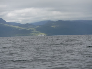
We launched from 'Carrot Park' on the Port Hardy waterfront. Beautiful day, light breeze as we shoved off. Paddled to Duval Point then crossed Golatas channel to Bell Island. Since the weather was beautiful and clear we decided to paddled on, crossing Gordon Channel. Gordon Channel is a VERY active shipping and cruise ship highway. We camped on Kent Island in the Walker Group. Loads of humpbacks in and around both the Walkers and Deserters Group. Next day we paddled to Shelter Bay. Good camping but real close to a fish farm. Moving on to Burnett Bay we did have some challenging conditions. Two swimmers attempting surf  landings was a bit unsettling ( note we paddled in 2 meter swell, plus some wind and very heavy fog). We all gathered at the south end of Burnett Bay which a two mile long flat sandy beach. We spent three days there waiting for the winds to die down, not a bad place to get 'stuck' for a couple days. There is two water sources here and a  'famous' cabin well worth exploring. (Note: the tannins in the water caused real havoc on our filter/pumps, and by the end of the trip we where boiling water for cooking). We did see bear and wolf tracks along the streams but had  no four legged visitors here or for that matter the entire trip. Rested and ready to go we left Burnett Bay very early for the 17mile paddle around Cape Caution on our way to our next camp site at 'Red Sand Beach'. Boomers in the fog and crashing surf at times was a bit concerning however this crux part of our journey was without  incident. Cape Caution is fully exposed to the Pacific Ocean and  is not merely a point, it is about a mile wide of challenging paddling. Red Sand beach  is beautiful with a nice camp site. Moving on, we crossed Smith and Browning passages on our way to our Crownstown Point campsite. This is another beautiful camp site. A real highlight of the trip was to lay on the beach and watch the Perseid Meteor showers ( I think assume is the appropriate adjective here).  We did chat with three paddlers from Seattle heading south  ( only other paddlers we would see) who were on a three month southern Alaska to Port Hardy trip. Paddling on Fitz Hugh Sound from here on is protected from the west by Calvert, Hecate and Hunter Island.  We have decided on Plan B at this point due to the three days we waited to round Cape Caution. Next stop is Fury Island. A beautiful (waterless) shell midden to camp on and it has a cabin which if empty can be used by anyone. We had a WONDERFUL Canadian couple waved us over and said they had caught too much salmon and wanted to share with us, O Yum, fresh Coho over the campfire that night was sooooo good. Next stop was Green Island, which looked from Google Earth and any documentation we read as a 'picnic' area and  it might have been many , many years before but now it was an over grown salal  bump of rock above the high water line which had to be home for the night. We had to let the boats float as it was impossible to drag them up the sheer rock face. We did move the lightest boat up to the campsite high about the high water line ( note: 14 foot high/low water exchanges during this time), always concerning letting boats float over night. They were all carefully tied bow and stern and where right where we left them the next morning. Moving on to Namo, an abandoned fish cannery we got there after a stop at a First Nations village (Heiltsuk and Owikeeno people ) at the Koeye River (note: well worth a stop here and ask for permission to land and visit their longhouse).  Namo is a ruins now, the last keepers left a year  before and since then all the windows have been broken, the factory is trashed and  I suspect all the houses have been gone over by souvenir seekers, too bad. We did explore the site despite all the Keep Out signs, careful to watch your step due to tons of nails, broken glass and who knows what is lying around.  We found a beach away from  the buildings to camp on. A creek next to where the cannery is located was a VERY active salmon stream and those d a r n fish jumped and splashed all night. Next up was to head north toward Kipling Island, then a group of  rocks with  a shipping light where we crossed Fitz Hugh Sound and paddled to Clayton Island. With the very high tides Clayton was not going to work so we went to Hunter Island. Stopping at a very large fresh water pool where we filled our water bladders and jumped in for a refreshing bath. Found a set of sea lion bones here. We traveled another mile north where we found a little island that we could all fit on ( note: 6 of us used  tents and two hammocks, three of us tent guys also had hammocks). Anyway, the water got a couple guy's wet at 2 am. After such a restless night we were off to Bella Bella and our ferry ride back to Port Hardy by 6:30am.Some folks hiked the three miles from the ferry terminal into Bella Bella for that first post paddle cheeseburger and beer. Not much happening in Bella Bella was the report back from the hikes.

It never rained once on us, weather was either thick fog or bright and sunny, quite warm days. Saw loads of humpbacks many with caves, a few grey whales, loads of sea lions, sea birds, the underwater  life along the rocks was dramatic.                    

Tuesday, August 11, 2015

Alaska - Etolin Island Paddle


Our original plan was to paddle from Wrangell AK to Kake AK.  The plan was worked out over months of planning. We had to consider ferry schedule to/from Bellingham WA to Wrangell AK and from Kake, AK back to Wrangell for our ride home. We planned to stay at US Forestry service cabins when we could. So after all the planning was done, and group members had their ferry reservations made ( including kayaks), lodging in Wrangell, Kake and back again in Wrangell booked, cabin reservations made,  the Alaskan Ferry system informed us that the Kake to Wrangell ferry schedule had been moved up a day which impacted our plans so we changed our plans to accommodate the ferry schedule. Then two days before we were to leave,
the ferry had mechanical issues in Juneau and the planned Friday departure eventually moved to Sunday morning which threw all our plans for cabins, and the Kake leg of our ferry plan into complete disarray. So we scratched the original plan and plan B was hatched which ended up being a wonderful roughly 145 mile paddle.

The group consisted of 6 highly skilled, experienced paddlers and one 'newbie'.


Here is our original plan:

Friday, July 17 – Carpool and drive to Bellingham, load boats and gear onto ferry, set up sleeping sites on rear deck or optional cabin, and settle in for a 6pm departure.

Saturday, July 18 – In route to Ketchikan.  Great sightseeing and opportunities to see orcas, humpback whales, and/or dolphins.

Sunday, July 19 – Ferry travels through Chatham Sound in BC and into SE Alaska.  Arrive in Ketchikan at 7am.  Leave Ketchikan at 9:00am and arrive in Wrangell at 2:30pm.   Explore the town of Wrangell, buy fuel and food, and stay at "Be Still" Bed & Breakfast one night.

Monday, July 20 – Paddle across the mouth of the Stikine River, north 12 miles and stay in The USFS Little Dry Island cabin for the night.

Tuesday-Wednesday, July 21-22 – Paddle 10 miles around Dry Island and the Stikine Delta to USFS Mallard Sough Cabin.  Explore the area with a possible paddle to the mouth of LeConte Bay, where we will see icebergs and seals.  Fishing opportunities too!

Thursday, July 23 – Enter Frederick Sound, paddle west to Mitkof Island, and find a campsite on the east side of Mitkof Island (8 miles).

Friday-Saturday, July 24-25 – Paddle past the town of Petersburg (lunch stop) then north up Kupreanof Island on to Five mile Creek (12 miles).  Stay two nights.  Opportunities for fishing, whale watching, and hiking on established trails.

Sunday, July 26 – Paddle 8 miles north to Twelve mile Cove.

Monday-Tuesday, July 27-28 – Paddle 10 miles north to Portage Bay and camp for two nights.  Good fishing and whale watching opportunities.

Wednesday, July 29 - Paddle 12 miles west and camp on near Big Creek.

Thursday, July 30 – Paddle 11 miles in the area where Frederick Sound and Stephens Passage intersect and camp near Punta Point.

Friday thru Saturday, July 31- Aug 1 – Paddle 15 miles south into Keku Strait and to Kake, Alaska and stay for one night.

Saturday, Aug 1 – Leave on Ferry (Taku) at 6:45pm.  Travel through Frederick Sound, Petersburg (10:45pm-11:30pm) and Wrangell Narrows. 

Sunday-Wednesday, Aug 2-5 – Arrive in Wrangell at 2:45pm.  Spend three nights in the "Be Still" Bed & Breakfast in Wrangell, Alaska.  Options on Monday and Tuesday for jet boat tours to see Anan Bear Observatory, Chief Shakes Lake & Hot Spring, walking tour of Wrangell, or the Stikine River.  Museums, restaurants, shops, native longhouse, and collections of totem poles to explore in town.

Wednesday-Friday, Aug 5-7 – Leave on Ferry (Columbia) at 6:45 am on August 5th.  Stop in Ketchikan from 12:45pm until 5:00pm.  Arrive in Bellingham at 8am on August 7th.  Great opportunities to see whales and dolphins while touring through British Columbia.  Unload boats and gear, and drive home.


And the trip we did: Circumnavigate Etolin Island

Sunday, July 19 – Carpool and drive to Bellingham, load boats and gear onto ferry, set up sleeping sites on rear deck or optional cabin, and settle in for a 1:00pm departure on July 19th.

Sunday, July 20 – Ferry north.

Monday, July 21 – In route to Wrangell, arriving at 3:15am.  Launch from beach near ferry.

Tuesday, July 22 – Paddle 17 miles south and camp at the sand spit on Turn Island.

Wednesday, July 22 – Start paddling early (to catch the ebbing tide) and paddle 18 miles through Zimovia Strait and camp in the last cove at the south end of Zimovia Strait on Etolin Island for the night.

Thursday-Friday, July 23-24 - Paddle 8 miles to USFS Frosty Bay Cabin and stay for two nights.  Great hiking and fishing opportunities!  Also, those who can get permits in advance ($10 each) could paddle 11 miles to Anan Wildlife Observatory to see the bears, fish, seals, eagles, etc.

Saturday, July 25 - Paddle 15 miles around the north end of Deer Island and south down Etolin Island, through Canoe Passage, and camp on the north side of Stone Islands.

Sunday, July 26 – Paddle 9 miles north to Kelp Point and camp on the low island just off of the north end of the point.

Monday, July 27– Paddle 12 miles north and find a campsite in or on Stanhope Island and Three Way Passage.

Tuesday-Wednesday, July 28-29 – Paddle 12 miles north and stay two nights in USFS Steamer Bay Cabin.

Thursday, July 30 – Paddle 14 miles north and camp at the last bay before Chichagof Pass.

Friday, July 31 – Paddle 17 miles northeast through Chichagof Pass to Wrangell.

 July 31-Aug 5 – Spend five nights in the "Be Still" Bed & Breakfast in Wrangell, Alaska. Take optional excursions Sunday-Wednesday, Aug 2-5 – Arrive in Wrangell at 2:45pm.  Spend three nights in the "Be Still" Bed & Breakfast in Wrangell, Alaska.  Options on Monday and Tuesday for jet boat tours to see Anan Bear Observatory, Chief Shakes Lake & Hot Spring, walking tour of Wrangell, or the Stikine River.  Museums, restaurants, shops, native longhouse, and collections of totem poles to explore in town.

Wednesday-Friday, Aug 5-7 – Leave on Ferry (Columbia) at 6:45 am on August 5th.  Stop in Ketchikan from 12:45pm until 5:00pm.  Arrive in Bellingham at 8am on August 7th.  Great opportunities to see whales and dolphins while touring through British Columbia.  Unload boats and gear, and drive home.

This is a remote destination paddle with a major portion of it in Tongass National Forrest which is a wilderness area. We did see lots of salmon fishing boats and loads of jumping salmon. While in Wrangell I saw both the Time Bandit and the Wizard of the TV show Deadliest Catch in port.  Lots of eagles, bears especially on the 'salmon' rivers and streams as this was a salmon run year it was easy to avoid those water sources. And I must say water sources was NOT an issue! We were told Wrangell had record rainfall while we were out on our trip. I can attest to hard rain day and night for the last portion of our paddle, but that made for some pretty spectacular waterfalls along the way. We had almost no wind during this trip so we pretty much travelled wherever we wanted, where outside coast line or wandering through the hundreds of islands.  Amazing jelly fish display in the channel between Etolin and Brownson Island, never seen so many and so many different species of jellyfish in one place.

If you have the time and money ( most excursions are not cheap), take a ride up to the Anan Bear Observatory ( met a couple that went three consecutive days in a row at $290 per person per trip) here you will see large number of grizzly and black bears trying to catch some of the 5,000 salmon that are heading to their spawning grounds that pass this point daily. The LeConte glacier and the icebergs it sheds are an amazing site to see. Wrangell has a real wonderful museum and is well worth the time to go thru, also several totems in parks around town. The Skikine Inn is the 'fancy' hotel in town and has both a good restraunt that servers 'Alaska sized portions' and coffee stand.   

So despite the rain and being wet a good deal, and those blood sucks no-seeum's which were abundant, Alaska is a magical place to paddle this was a wonderful trip and which I'd do  again.

Tuesday, August 5, 2014

La Push WA Paddle July 2014


July 2014 La Push WA

Paddled with a group of WKC ( Washington Kayak Club) friends launching at the Quillayute River marina. Paddled to Mosquito Cove some 11 miles to the south which was our intended campsite. Fog... lots of fog and winds in the 15-25k range for this trip with loads of sunshine. Numerous sea caves and arches to explore, rock gardens with a wide variety of sea life, birds, sea lions and seals.

We stayed at Mosquito Creek for four nights, great place to camp with a good water supply and miles of sandy beaches to hike. One day we attempted to hike down to Hon (rain forest) river but three of us turned back after a hour and half of slogging thru mud pits, climbing latter's and ropes, walking over skinny log bridges ect...guess I'm not cut out to be a wilderness hiker! Moved our camp to a site north of Toleak Point for our final night. On the last day we here on the water by 7:30 am and paddled most of the way back to La Push in fog.

Did day paddles down to Hon river, around Alexander Island, up to and down Goodman Creek ( nice river otter population there). The number of brown pelicans was huge, hundreds of their spend time around Mosquito Creek... also saw a large number of puffins, they are just too cool.

Since it was windy, bugs where no problem, tents with lots of sand in em a problem.


Balaclava Island ( BC ) Paddle July 2014


July 12- 20, 2014

God's Pocket area, are a group of islands northeast of the very top of Vancouver Island. We camped at Nolan Point on Balaklava Island.

Paddled out of Port Hardy around 7:30 am and followed the coast line up to a point across from Duncan Island where we crossed over in a light fog.  Once across we padded past Blyth Island and the Nobel Islets ( one has a light on it ) on our way to Nolan Point on Balaklava. Arrived around noon on this 11 mile paddle. We camped there with a few other folks but all in all it was sunny, peaceful and quite.

Paddled each day, first around Bakaklava, up to Clam Cove ( water source), toured the Light House and chatted with the lighthouse keeps ( east side of the island), visited God's Pocket resort on Hurst Island, paddled around Hurst Island many paddles along Browning Wall on Nigei Island, and Port Alexander. The sea life ( jellyfish, sea stars) along Browning Wall were incredible. You can find culturally modified trees close to the Nolan Point campsite.

We had the opportunity to watch some of BC's finest put out a 'root' fire about a half mile from our campsite. They said the fire probably was burning in the root system for about ten days before the smoke appeared. A good reminder to have your campfires close to the beach and not in the forest.     

We saw Orca's, sea otters, wolves, ton's of sea birds, eagles, ravens some breaching whales from  a 1/4 miles away ( in big swell and 20k winds ). No raccoons or mice visited, deer flies visited occasionally, some mosquitoes but all in all bugs where not a big pain.    


Sunday, April 14, 2013

Gentle Giant

Took at ride today over to Seahurst Park in Burien, WA where a 65ft Fin whale which was estimated (when alive) to weigh between 100,000 to 120, 000 pounds, washed up on shore.  This gentle giant of the deep had been struck by a ship and died six days before it arrived in the Puget Sound.

Saturday, January 12, 2013

Skagit River Eagle Paddle


Today was a beautiful day to be up in the Cascade Mountains in Washington State. I joined a group of BEWET ( Boeing rafters and kayakers) folks on a 10 mile trip down the Skagit River. This time of year thousands of Chum salmon end their life journey and the eagles, hawks, ravens and the ever present crows dine on salmon.  The paddle took two and a half hours to float down and admire the eagles as they perch along the river. 19 degrees under crystal clear blue skies, a great day to be alive!

Wednesday, January 9, 2013

2013 New Year's Challenge

Again this year I joined a diverse group of paddlers to race in the 4th annual New Year's Challenge, a human powered water craft race showcasing a wide variety of rowing and paddling enthusiasts of all skill levels willing to brave the cold and compete in this traditional event of the new year. 112 paddlers powering racing shells, outrigger canoes, stand up boards, prone boards, surf skies, kayaks and large dragon boats participated. The race starts at Gasworks Park on Seattle's Lake Union passes thru Montlake Cut past the University of Washington  and ends at Magnuson Park on Lake Washington a distance of 6 1/2 miles. I finished 60th overall, third in the SK-M class and improved my finish time by almost 3 minutes this year,  yeah!
60 Bill Porter SK-M 1:18:43.0


+30:35.6