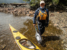
| 60 | Bill Porter | SK-M | 1:18:43.0 |    |
Wednesday, January 9, 2013
2013 New Year's Challenge
Again this year I joined a diverse group of paddlers to race in the 4th annual New Year's Challenge, a human powered water craft race showcasing a wide variety of rowing and paddling enthusiasts of all skill levels willing to brave the cold and compete in this traditional event of the new year. 112 paddlers powering racing shells, outrigger canoes, stand up boards, prone boards, surf skies, kayaks and large dragon boats participated. The race starts at Gasworks Park on Seattle's Lake Union passes thru Montlake Cut past the University of Washington and ends at Magnuson Park on Lake Washington a distance of 6 1/2 miles. I finished 60th overall, third in the SK-M class and improved my finish time by almost 3 minutes this year, yeah!


Sunday, December 30, 2012
Harstene Island Circumnavigation Dec 2012
Harstene Island Circumnavigation Dec 2012
A group of four hardy paddlers participated in sixth annual
late December paddle. This year we left on December 27th from Joemma Beach
State Park (N47 13.620 W122 48.582) which is located on the Key Peninsula in
south Puget Sound. A nice 10 kt breeze under
sunny skies accompanied us as we crossed over to Harestene Island and then thru
Dana Passage on our way to Hope Island SP.
Hope Island State Park (N47 11.017 W122 55.940) was approximately
a 12 nm journey from Joemma. We arrived around 1:30pm and pitched our tents under
sunny skies. Plenty of time to check out the historic old farm house located on
the island and for a hike along the well marked hiking trails that criss-cross
the island. We had the island to
ourselves except for the beligerent gang of raccoons who were playing some kind
of war games that required screaming at one another. Sure gets dark early this
time of the year ! With a full moon and a coyote or two howling in the distance
it hard to believe this quiet little island is surrounded by a heavily populated
metropolitan area.
Gets light around 7 am, so we take our time with breakfast
and packing the boats, no need to start
early. As dawn breaks the south side of Mt Rainier is bathed in sunlight and ice
and snow turned a deep red as the sun rose. Marine weatherman is again
predicting calm conditions with a possible shower and sun breaks. Packed and
ready to go, we launched at 10:30ish to continue our journey along the eastern
side of Squaxin Island and Harstene Island on our way to Jerrell Cover SP where
we will camp for the second night. Lots
of wintering birds, a few seals, eagles and the ever present gulls accompany us
on our paddle. A quick stretch / bio break stop at the little park by the Latimer
Landing bridge and we complete the 10.3 km paddle to Jarrell Cove around 1 pm.
Jarrell Cove State Park (N47 17.063 W 122 53.105) as did Hope
Island SP have Washington Water Trails sites located on them. Since this park
is completely empty we opt for a campsite right next to a nice shelter covering
three pick nick tables which comes in handy when the rains returned. Jarrell Cove
has a nice new bathroom facilities complete with showers ( bring your quarters
to feed the showers) and water is available from several spigots located around
the camp grounds. Jarrell Cove is located across a small cove from a small
marina which seems to be closed this time of year. Only visitor here where a
few folks walking their dogs and several deer AND a visitor who arrived after
dark in the rain bearing firewood and fermented beverages. THANK YOU Mike
G...you might have gotten in trouble at home but four cold, wet kayakers
standing out in the drizzle huddled around a campfire were singing your praises.
Up and on our way at 8:30 am the sunlight is reflecting off
the snow covered peaks of the Olympic mountains this fine morning, again a
beautiful sunny morning. The night time temperatures have not dropped below
freezing the entire trip, and during the we have had temps in the mid to upper
forties, very pleasant for late December. Our
plan for today is to stop at McMicken Island SP for a quick stretch before
crossing Case Inlet on our way back to our journeys starting point, Joemma
Beach SP. The 12.2 nm trip successful competes with a 'we cheated death' group
hug. If you make it over to Joemma be sure to stop for breakfast or lunch at
LuLu's, a dose of local culture is good for the belly and soul.


Sunday, December 23, 2012
Deception Pass DASH 2012
This was my 6th year doing the DP DASH. Good to see lots of paddling friends at this annual event. This year there where almost 100 racers paddling all sorts of water craft.
No concern for frost bite or over heating... a nice cool drizzle fell, 38 degrees and a 15 kt breeze out of the east..
I finished 53rd with a time of 1hr 15 minutes and 45 seconds.......blazing speed for an old guy!
No concern for frost bite or over heating... a nice cool drizzle fell, 38 degrees and a 15 kt breeze out of the east..
I finished 53rd with a time of 1hr 15 minutes and 45 seconds.......blazing speed for an old guy!
Wednesday, October 17, 2012
Diablo & Gorge lakes paddle WA
September 17/18, 2011
Diablo Lake / Gorge
Lake – SK II-III
Paddle in the North Cascades area, enjoy a long weekend of peaceful
remote camping. The lake can get windy, so you should be comfortable paddling
in windy conditions. Come up and paddle for a day or spend the night and paddle
both days. We'll see fall colors and spectacular wilderness scenery, beautiful
canyons, wonderful waterfalls and creeks, plenty of opportunities to take a
picture or two ! Very nice ( free
campsites ) with bear lockers, tables and campfire rings and other
'essential" facilities.
Under sunny fall skies the group first paddled Diablo lakes translucent
blue waters. Calm breezes we paddled the roughly 10 miles circumnavigating the
lake. Got out at the Diablo dam and hiked along the spillway, either by kayak or car this is a real scenic
stop and well worth the trip up into the north Cascades.


Sunday, July 22, 2012
Quatsino Sound to Solander Island (almost)

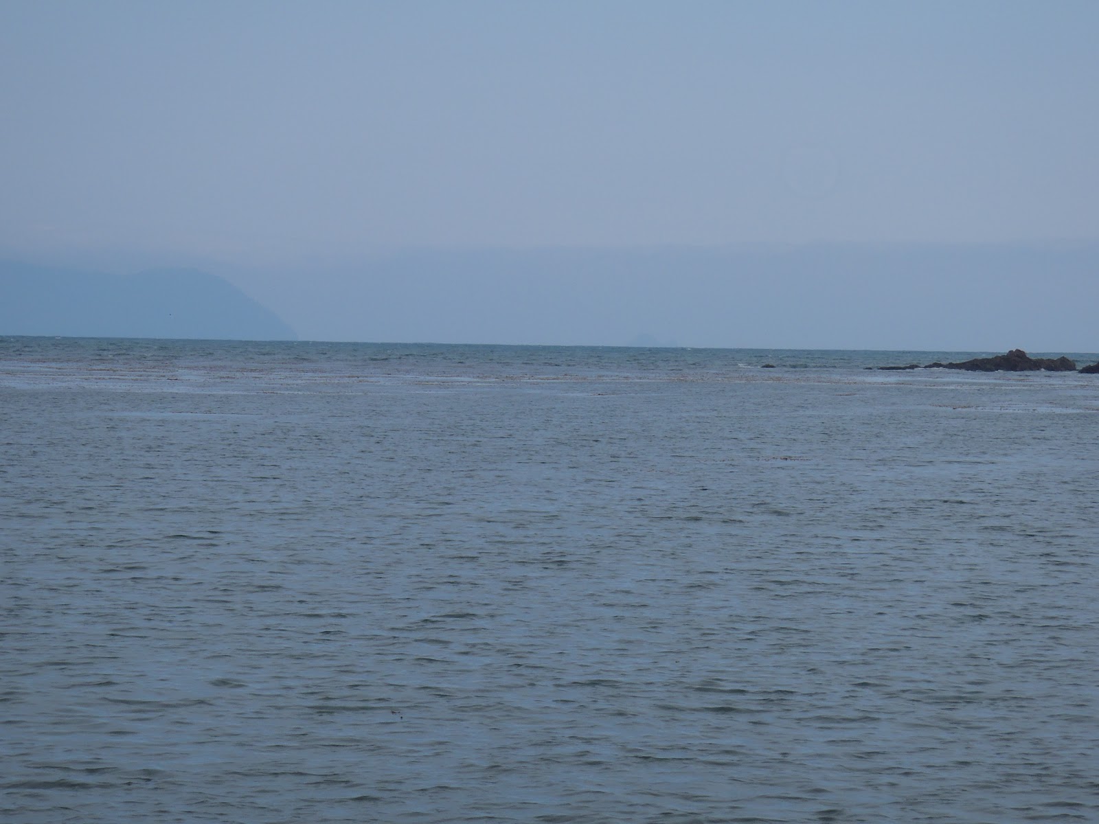

Coal Harbour, BC to Solander Island ( almost !)
It's Friday, July 6th, up at 2:00 am and out of my Kirkland,
WA home on my way to Everett, WA to pickup paddling bud, Rob...
Two hour drive north up I-5 on the way to the Peach Arch
border crossing which we arrive at 4:35 am.. We are the only vehicle crossing
the US / Canadian border at that early time, a question or two from the
Canadian border guard and we are on our way to the Tsawwassen BC Ferry dock. Due
to a lot of large trucks heading to Nanaimo (Duke Point) we missed the 5:45am
sailing, I had reservations on the 7:30 am sailing so we had the pleasure of a
slow breakfast as we waited. The two and a half hour ferry ride to Nanaimo then
a five plus hour drive to Port Hardy BC and the first portion of the trip is in
the books. Plan was to spend Saturday getting supplies and finding a place in
Coal Harbour, our launch site to park the truck for our planned 10-12 day
paddle.
Saturday we spent a good two hours touring
the WW2 Canadian seaplane base and discussing airplanes with Joel the
proprietor, what an interesting, colorful character! He has some awesome photos from the
RCAF days and a cut-away R-985 motor, a metal workshop and wood workshop, plus
a Model T in mint condition. His business is Air Cab's at Coal Harbour,
Vancouver Island (http://www.flickr.com/photos/flyingaxel/6111214251/). For $40
bucks we had a parking place which is right on the water. Well worth the cost
plus one of the great bonuses of paddling out of Coal Harbour is you can stay
in Pt Hardy and drive the 16 miles on paved roads to Coal Harbour vs.
the 25 mph, three hour ride on kidney
jarring logging roads to most other towns on the west side of Vancouver Island .
Sunday July 8th.
Up and out the hotel doors at 4:30 am heading
to Coal Harbour. We have the boats
loaded and are on our way to Quatsino Narrows, a one and 1/3 mile stretch of
'very active water' on our paddle to Spencer Cove which is our day 1
destination. One wants to carefully
review the paddling plan for a trip through the Narrows as you will encounter
large whirlpools, over falls, up wellings and fast moving water. FUN stuff!!
Spencer Cove is a place to camp, ( enough said ) it is a space provided by a
logging company primarily inhabited on weekends by folks who seem to like
running their four-wheel off road buggies up and down the de-forested hillside.
But after a lot of miles and long day on the water it is a welcomed place to
put up our tents for the night. Spencer Cove is 17.2KM from our launch site at
Coal Harbour. Weather was sunny and temperature in the high sixties with
minimal breezes.
Monday July 9th.
Up and on our way by 7:30am, today we will
paddle out to Lawn Point on the coast. Pleasant paddle in and around a number
of small islands on our way to Cliffe Point. Once past Cliffe Point you lose
the protection of the land and mountains and start to experience the swell from
the ocean. Lots and lots of sea otters in the kelp beds as we journey to Lawn
Point, seems like most of the groups we see are mothers with their little ones
riding on moms belly as she swims on her back. Very encouraging to see such
large rafts of these floating fur balls. We stop in Restless Bight, which has
(guessing) a mile long white sand beach for lunch and a stretch. A number of reefs from just north of Kwakiutl
Point down to Lawn Point keep the water in this area 'lively', pay attention to the breaking swell and
boomers when paddling in this area.
We arrive at Lawn Point around 1:30pm, again
we paddled under bright blue skies, minimal wind and temps in the upper 60's.
Paddled 13.5KM on this leg.
Tuesday July 10th
Today was a planned non-paddle day. Exploring
the miles of beach on Lawn Point was the plan. Again bright blue skies, mid
60's and a nice ocean breeze are today's pleasant conditions. We share the beach with a very inquisitive
mink who patrols the area and generally ignores it's two new neighbor's. We
also discovered a very large number of grass snakes living under a piece of
black discarded plastic. Good to have these kinds of neighbors as there will
not be any mice/rodents getting into our
gear, tents, food. One area interest for me, now that we have paddled several
miles of coast line was the impact on the beaches of the Japanese tsunami,
beaches where absolutely clean of any debris that we could see, a very real relief
I'm sure for the local tribes and those of us to enjoy the BC coastal paddling
experience. The beaches at Lawn Point have a lot of beach glass gems washed up
on them daily, so collector's like myself have lots of colorful souvenirs and
another 5 lbs in my boat to haul around. Another note, Lawn Point- 'Goggle
Earth it' and from space it looks like your average well manicured front yard,
in actuality ( my opinion) it's covered with 4 ft high razor- grass which I believed
is host to all sorts of invisible vampire like creatures that drain your blood
and leave welts that itch for days, but again that is only my opinion.
Wednesday July 11th
This morning we are heading to Heater Point
which is where we will set up our next camp. I'm really looking forward to our
planned day paddles from this location, large sea caves and a waterfall right
at the sea's edge, along with large numbers of sea birds which live on the
protected islets in the area. Again, a
clear blue sky, same sea breeze and mild temperatures greet this morning. We can see in the
distance a thick fog bank covers our intended destination. We will be crossing
Klasino Inlet on this roughly 8KM paddle to Heater Point. Today, as each of the previous days on this
paddle we see no humans, there is a sailboat leaving the inlet heading north
but out here on the coast there are few humans that you come into contact with.
During our crossing we see a number of
sea otters and a group of puffins ( they are just too cool ) fishing for their breakfast. As we approached Heater Point we disappear into the thick sea fog,
very eerie, not being able to see very far yet hearing the crashing of the
surf. After a bit of poking around we
found our next camp, and what an incredibility
beautiful place to camp. Recent guest who left their footprints in the
sand were bears, deer and a wolf. A clear, fast running stream on the east end
of the beach flows out of the surrounding steep hills. On the opposite end of
the beach there was a small water fall. Note: due the extremely wet spring and
early summer in this part of the world there was NO problem finding a good
water supply.
By the time we had our tents up the fog
disappeared and the blue skies returned to this relatively small beach, my
guess a 100-150 yards wide. Listening
to a marine weather radio later that afternoon alerted us to a forecast that
had changed quite significantly. A high pressure system in the gulf of Alaska
was intensifying and serious winds were expected for the foreseeable future,
significant winds are in the 30 - 45 knot range out of the northwest. After a discussion and even though Solander
Island was clearly visible and it sure would be fun if one had another week to
attempt the paddle we decided that we would get up early and head back to Lawn
Point and if possible round the Kwakiutl Point headland.
Thursday July 12th
Another early morning of blue skies but this
morning the winds from the northwest were evident. Listening to the marine
radio confirmed the previous evenings forecast of significant northwesterly winds
and the high pressure system was continuing to intensify. We launch at 7:00 am
from Heater Pt and paddled into the 15k winds on Klaskino Inlet this time paddling
with the ebbing current made for a much quicker trip back to the Lawn Pt
area. Wanting to take advantage of the
push we where receiving from the ebb current we continued on paddling around
the Lawn Pt and Kwakiutl Pt headlands. A bumpy but very manageable paddle. Our next camp was located on a small island
on the southwest corner of Restless Bight. On the north side of our little
island you could barely stand up in the face of the wind while on the
south-side of the island you would hardly know the wind was blowing at all! The
new plan immediately became we would spend two nights on this island's white sandy beach. Water was readily
available at the south end of Restless Bight and it was roughly a one mile
protected paddle to get to the water source.
Weather forecast was for 2-3 meter swell building to 3-4 meter swell
with 35 - 45K winds.. yikes... for the next three days.
Friday July 13th
Again, beautiful bright sunny skies this morning,
warm and very windy. Today, I thought I would try some fishing with my hand-line
since I drug some lures and fishing gear with me. In the afternoon I paddled out to a kelp beds
on the east end of the island but with the wind it just made for way too wiggly
conditions to fish and I gave up after 45 minutes. The wind and waves made for
fun conditions as I paddle the three miles across to the eastern shoreline of
Restless Cove to do some exploring. Also,
I wanted to see what kind of conditions we would experience as our current plan
was to get up the next morning around 4:00 am pack our boats and head towards
the west entrance of Quatsino Sound. After
checking out the shoreline I headed to the southern end of the Bight to re-fill
our MSR water bags. A fast flowing creek empties onto a flat mile long white
sandy beach.. Great place to explore... Back in camp, after dinner we
experienced one of the thrills of nature as three Orca's swam right past our
campsite. A large male accompanied by two females. One female leaped out of the
water, I assume she was checking the rocky shore line of seals. Quite impressive
to see a 19 foot long 8,000 pound flying
fish! The male and other female followed close behind the first Orca, his 6
foot dorsal fin was all we saw of him. With the 35 kt winds and 3 meter sea's
the three Orcas disappeared into
churning white-capped seas. Friday the 13th, a very lucky day ! Another note,
with no light pollution from any source out on the coast it's worth getting up
between midnight and three am just to admire the stars, the view of the Milky
Way which I don't have words to describe was simply incredible.
Saturday July 14th
Up at 4:00 am to pack, eat and hit the water.
Didn't sleep particularly well as the wind howled all night and as day breaks
this morning the wind is still brisk out of the northwest to say the
least. The moon and a couple of planets
are the bright lights in yet another cloudless morning. At 5:15am we say good-by to our very comfy
island home and head out on our three mile plus crossing of Restless Bight. Big
water but the waves are very predictable during our crossing. Closer to the
eastern shoreline the big swell bouncing off the rocky shoreline add to the fun
of the adventure. Once we enter the
southern end of Rowley Reefs area we could see the flat waters of Quatsino
Sound in the distance. The powerful ocean waters now have become relatively
tranquil. Originally we planned to cross
Restless Bight taking advantage of the flood ( turned out it took us all of 45
minutes to cross) then decide based on
conditions whether to call it a day or continue on but with the protection of
Rowley Reef we paddle past Gooding Cove, Harvey Cove and continue on towards
Clifffe Point. Lots of interesting shoreline to paddle in the company of sea
otter, puffins, seals and hosts of seabirds, rocky outcrops and sheer cliffs.
We also see lots of fishing boats who are taking advantage of the protected
waters of Quatsino Sound. A small pocket
beach west of Koskimo Island in the aptly named Koskimo Bay will be our
campsite for this evening. Maybe75 yards wide with a nice cold running steam on
one end, perfect! Wash the salt off all the gear and body. Did I say another
bright blue sky, light breeze and 65-70 degree day.
Sunday July
15
The flood current starts late today for today's planned paddle
to Ilstad Island, our final campsite on this trip which is only 8 miles away.
Yes, it was another sunny day, little breeze and temperatures ( I'm guessing)
pushing the 70's. We paddle past several fish farms and logging operations, the
logging has impacted the snow covered mountains in the Sound and guessing the
fish farms impact the water quality. Progress,
quality of life and jobs or not, an interesting debate. Ilstad is really two
small islands with a 100 yard- wide saltwater mud flat connecting the two small
rocky islands. Accommodations are fine,
plenty of room to camp and the shoreline is covered with sandstone rocks with
unique features carved into them by wind and water over time.
Monday July 16
Our last day on the water, geez these paddle
trips are over way too fast! This morning we are up very early, have to plan
for the flood current through Quatsino Narrows. The campsite is approximately five miles from the entrance of the Narrows
and dare I say the day is going to be another sunny, bright blue skied day!
Packed and on our way, we pass by the small First Nations village of Quatsino.
The rays of the sun are just peaking over the snow caped mountain and shining
directly on to the villages cemetery, cool visual early in the morning. On queue an eagle dives out of the sky to nab
a fish right in front of our boats, eagles are more numerous than crows and
ravens in this part of the world, it seems.
We stop for a stretch before entering into the active waters of the
Narrows. The narrows are running a 4+
knots today ( sure would be fun to see it running at the7-8-9 knots that do occur
here ) and we float through as if on a river.
Several locals suggested the trip into Varney Bay and a paddle up the
Marble River which is a whitewater paddlers 'must paddle spot'. We paddle a
couple of miles up the river and are able to struggle past the first set of
rapids but the second set of rapids is not for meant for sea kayaks. Absolutely
worth the effort to paddle into the cold, freshwater, high rock lined cavern.
We float down the river and into Holberg Inlet for the four mile trip back to
where our journey started in Coal Harbour.
Monday, May 21, 2012
Shaw Island, San Juans Washington State


Washington Kayak Club 'Round Shaw Island' trip
report...
Rhonda, Chris, Z, Jon, Marty, Beth, Rob and Bill left Oldin
Park on the northwest corner of Lopez Island under beautiful, sunny blue skies
at 9:30 am for a counterclockwise paddle around Shaw Island. First stop on the
trip was a quick tour of Blind Island and the WWTA site complete with
state-O-the-art rest stop accommodations. After a snack and rest break we
headed west towards Wasp Passage where we encountered a barge carrying a float plane on its deck, an
unusual site to see..
Stopped at a small, sunny,
oyster covered pocket beach along Wasp Passage for lunch and a snooze. Thanks
Marty for the fresh baked raspberry pie, it's really, really tough roughing it
out here in the San Juan's!
Back on the water we round Neck Point and turn
southeast for the final leg of the
journey. Eddy hopping in and out of the Madrona tree lined bays and inlets
along the west side of the island. Some fun tide races to play in as we passed
by Hicks Bay and Hoffman Cove before rounding the southernmost point of Shaw
Island into Upright Channel on our way to Flat Point on the Lopez side of the
channel and our home base at Oldin. Arrived 'home' around 3:30pm unpacked and
headed to town for a good dinner at the
Galley followed by another fire on the beach...
Sunday, March 25, 2012
WKC Paddle Seahurst Park March 24, 2012
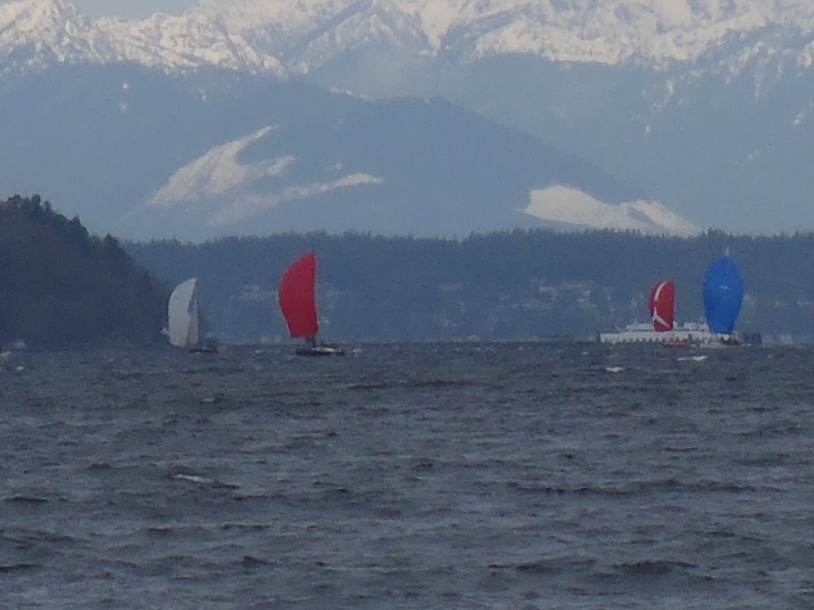


A select group of highly experienced paddlers left the beach at Seahurst Park on March 24th for a
three hour tour......
Well, actually six WKC'ers showed up for a 'get the dust your boat' paddle under mostly sunny skies and temp's in the high 50's, could spring really be here ? We paddled north towards the Fauntleroy ferry dock in the face of a brisk 15-20 Kn northerly wind which made for nice 2-3 foot wind waves and an occasional salt spray in our faces before returning to Seahurst. The Sound was covered by what looked to be 60-70 sailboats. The sailboats with their brightly colored sails and a back drop of the snow covered Olympic Mountains bathed in bright sunlight made for a photographers dream picture,unfortunately I was the skill-less photographer taking pictures..
Any how it was a great day to be on the water in the company of fellow paddling buds..
three hour tour......
Well, actually six WKC'ers showed up for a 'get the dust your boat' paddle under mostly sunny skies and temp's in the high 50's, could spring really be here ? We paddled north towards the Fauntleroy ferry dock in the face of a brisk 15-20 Kn northerly wind which made for nice 2-3 foot wind waves and an occasional salt spray in our faces before returning to Seahurst. The Sound was covered by what looked to be 60-70 sailboats. The sailboats with their brightly colored sails and a back drop of the snow covered Olympic Mountains bathed in bright sunlight made for a photographers dream picture,unfortunately I was the skill-less photographer taking pictures..
Any how it was a great day to be on the water in the company of fellow paddling buds..
Subscribe to:
Posts (Atom)